ATP Quick Links
Interested in Alaska?
Seeking a Job?
Signed a Contract?
Contact & Support


If you have already learned a little about your potential
opportunities and challenges in our state from either the
ATP page about Alaska
itself, or the one about teaching
in
Alaska, then you are already ahead of many other
candidates. Research is
essential to finding "the right fit" with a district and job
that meet your specific expectations and skills.
ATP has been compared to a "matchmaker" for job candidates
and school districts. It's a good analogy, and we actually
studied effective on-line dating systems in designing the
earlier versions of this website.
Alaska has opportunities, and challenges you won’t find
elsewhere. It is important to be an educated job candidate
if you are going to find a good match for both your
professional skills and interests, and your lifestyle
requirements.
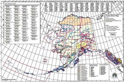
The image above links to a very detailed map of Alaska's
school districts, and is indexed by village name. Our
website has an entire page about Alaska's
school
districts. So, we won't replicate that information
here.
If you haven't been there yet, take a peek at:
Not only will districts be impressed when you demonstrate your knowledge about them, they will realize that you are a serious, informed candidate.
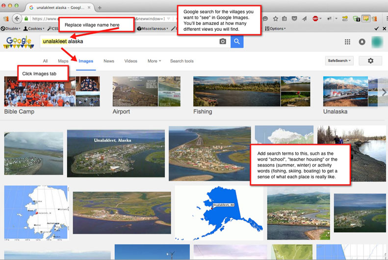
There are some excellent resources available for
researching specific villages. Many of these did not exist
even a couple of years ago in a web-accessible format.
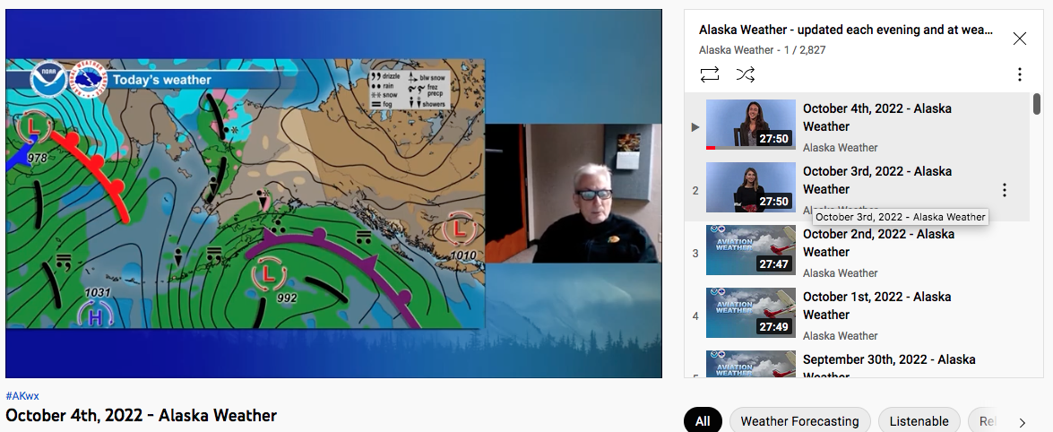
For many years, the most popular show in rural Alaska has
been Alaska Weather.
Why? Weather is essential to travel by small airplane,
snowmobile, and skiff. And, for keeping subsistence fishers
and hunters safe. Heck, for just about everything.
Originally, the show was broadcast statewide on the Rural
Alaska Television Network (RATNET), a single television
station that combined feeds from all the major networks into
one channel. It is now produced by
KUAC-TV, KTOO 360TV, and streamed on the Internet.
Alaska Weather is a detailed, daily 30-minute long weather
forecast that covers the whole state. You will begin to see
how very large, and diverse Alaska is in one or two shows.
Trust us. It's great for getting feel for Alaska's
weather
in the various regions throughout the year.
Drop in on their YouTube channel
for daily updates, or scan their archives for different
times of year to see what the weather is like in the regions
you are considering in October, November, February, April
and May. Click the link to the image below, and you
will find the talk of "passes" open and closed, icing,
turbulence, sea conditions and so on very interesting!
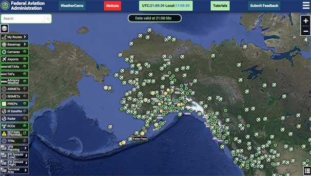
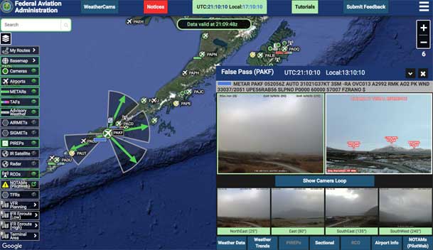
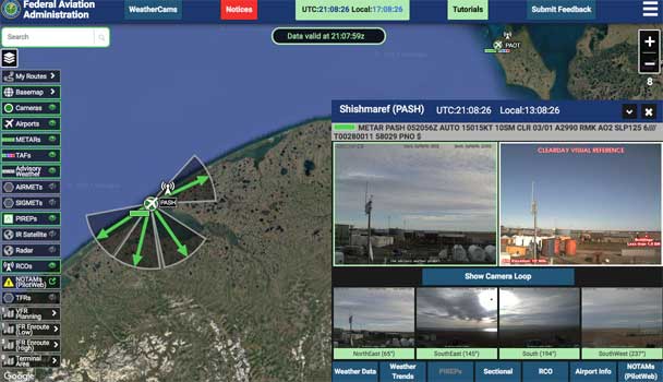
The FAA has recently spent significant time and energy
putting in a series of high tech
Automated Weather Observing Systems (AWOS)
throughout the state. Although parts of the FAA weather
camera system have existed for a decade or so, the
technology has really matured, and the FAA has expanded its
efforts aggressively.
The network is coming to completion now (October,
2022), and provides continuous, real-time and accurate
weather information, as well as cameras facing in different
directions for nearly every village in the state. It's quite
impressive, and allows you to look live in the village of
your choice in real time by clicking the icon on the map.
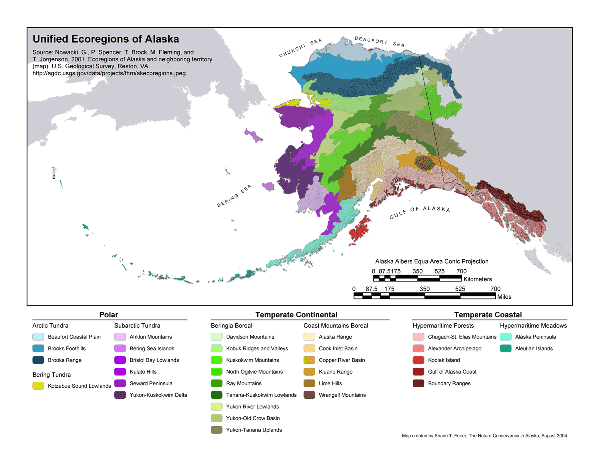
The geographic, climate and
vegetation zones do not match up exactly with the
regions described above, but they do in a rough sense.
If you click the USGS
report image above, it will open a larger, more
detailed version of this map, and that will help you
understand the descriptions below. There is also
another version of this data in large
scale PDF format.
Hopefully, these resources, when combined with our other
pages, will allow teacher candidates to research regions and
school districts around the state as they proceed through
the stages of their job search.
Don't forget to visit the ATP Forum
and post questions that may come up during your research! To
register, either use the forum's interface, or email ATP
Tech Support with a username you'd like, and an email
address to use. We'll do the rest.